Map of the Invasion of France as Revealed to Marie-Julie Jahenny
The map of the coming invasions (above) points to Russian alliances with China and the Arabs.
The red areas are areas that are destroyed, diagonal red lines show areas with severe earthquakes, and the much, much smaller blue areas are the protected areas.
Marian apparition sites are protected areas also.
The blue lines with arrows indicate the evacuees going into Brittany.
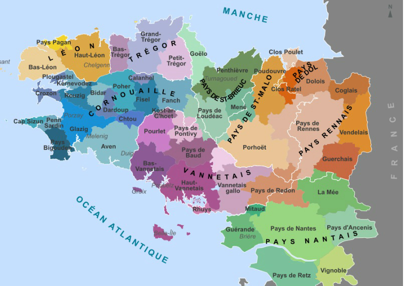
Below is a map of Brittany's land mass during Marie-Julie's lifetime.
Notice that Mont St. Michel, on the northern coast, in the Pays de Dol, was also part of Brittany.
The parish of Nantes, comprised of the green areas to the south, is now called the Loire Valley Department. This is where the Jahenny family lived.
Brittany (these coloured areas) will be protected, and half of the crops will still be growing here after the 3 Days of Darkness.